Fall/Winter Fluctuation
 Last Thursday I set out on a near loop trip from Durango to Mesa Verde. A storm was approaching from the south, so precipitation was expected. But in the morning, all was tranquil along the Animas River in downtown Durango, where there is a fine walkway/bikeway along the water.
The San Juan county courthouse in Silverton.
 The countryside between Silverton and Red Mountain Pass is laden with various minerals, which add to the scenery.
 Mining operations continued on Red Mountain Pass til the mid 20th century. The company that did the mining still exists and is working on site restoration.
 Any idea on why it's called Red Mountain? The colors of the terrain blend nicely with the aspens. This pic was taken around noon...still no precipitation. But it was approaching from the south.
 On the road south of Red Mountain Pass, there is a platform built out over a canyon with a sheer drop of several hundred feet. Go out on the platform and you get this view of a waterfall...perhaps 250 feet high...dropping out of a glacial hanging valley into the gorge below.
 This scene is just east of the town of Ridgway, which is between Ouray and Montrose. It's looking south, with the clouds gathering over the peaks.
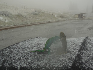
 And now I'm at Lizard Head Pass, up in those mountains at 10,222 feet. Snowing merrily! The Lizards do not like this type of weather. They were saying, "Get us to Phoenix ASAP!" Through the fog here, I could hear sheep baaing and their herders whistling...couldn't see them, though.
 The snow was sticking on the spruce trees at the pass, creating a primeval boreal effect similar to a winter scene in the Cascades.
 I descended the pass to Rico, elevation 8800 feet. There was an awesome aspen grove immediately south of town, its brilliance muted a bit by the rain, snow, and fog.
 I advanced to Mesa Verde, which was shrouded in rain and fog. It's always a mystical scene when an area receives unusual weather, which was certainly the case here.
 And at the end of the day, from my balcony at Far View Lodge in the park, the light was sublime.


 And at the end of the day, this was the view from my deck at the Far View Lodge in Mesa Verde.


 Kiger Gorge, a perfect U-shaped glacial valley. The notch at the top of the wall was also cut by ice overflowing the top of the ridge.


