Monday, June 25, 2012

More Acadia plus Portland...Maine!

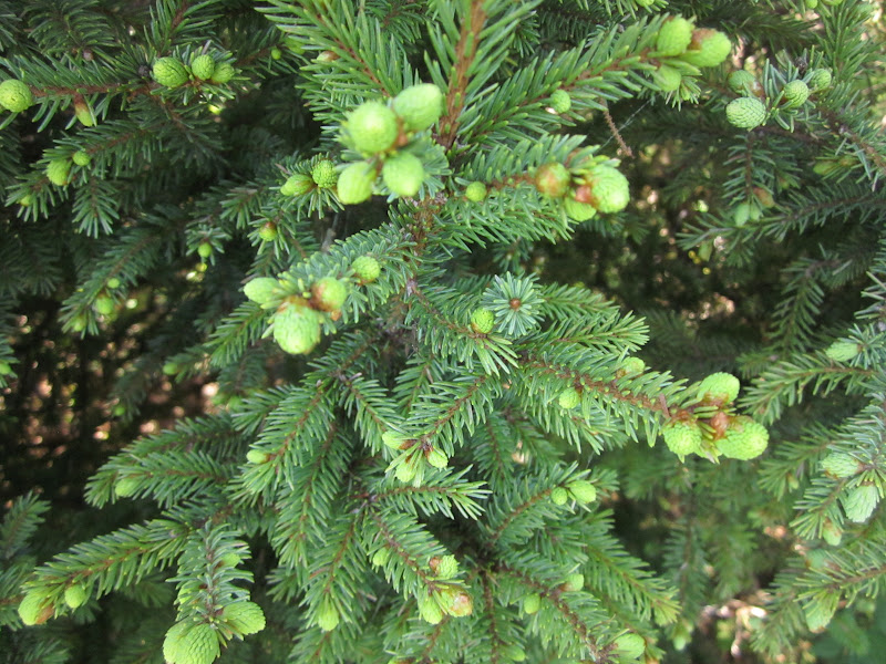
More shots from Acadia.  This one was taken at the summit of Cadillac Mountain, 1500 feet above the sea.  Fog was racing across the landscape, which looked positively Northern Canadian with the granite and stunted trees.

Like the rest of New England, Acadia was scoured by glaciers during the Ice Age.  This boulder is another one of my favorites...a glacial erratic! 

The rugged Maine coast.  Maine's shoreline is singular in the Eastern US...it's the only state with a rocky, precipitous Atlantic coast.  From Cape Cod south to Florida, it's all low lying sand dunes.

The pink granite of Acadia is striking when the light's good.

The granite proved excellent for slotation, which I effected for a pleasant half hour.

Now I'm in Portland...Maine!  Growing up in Portland, Oregon, I learned in third grade history that my home town was named after Portland, Maine, because William Pettygrove, from Maine, had won a coin flip with Asa Lovejoy, from Boston.  It occurred in 1843 when both men had purchased land in a new settlement on the Willamette River that had previously been called Stumptown.  They each wanted to affix a more dignified name to the place...the major city in their home state.  To decide who would get his way, they did the coin toss.  The coin, an 1836 large cent, can be viewed in the Oregon Historical Society.  I had always wondered what Portland, Maine was like.  I visited briefly in 2006, and explored in more depth today...I'm staying overnight here.  Actually, the two Portlands resemble each other.  Each has a funky alternative scene, with many individualistic restaurants and brewpubs.  They're both major ports, with a lot of water around.  They both sport cool Victorian architecture.  And, yeah, they both have a lot of crummy weather...i.e. wet, and occasionally icy in winter.  Portland Maine gets a lot more snow.

A typical street in the Old Port section of Portland.  Looks like England or Ireland with all the adjacent brick townhouses.

The architecture on the side streets of Old Port is equally old, but less substantial.  You can almost see the sailors roaming these alleys more than a century ago, getting into trouble, being rowdy.

A typical eating/drinking establishment in downtown Portland. 

During much of the 19th century, Portland was one of the leading ports of the US.  Many of the merchants and sea captains who drove that economy built mansions here in the East End, about a mile from downtown on top of a bluff overlooking Casco Bay.  This is a fine area for strolling, and enjoying the water view at sunset.  It's a nice 'hood.

The architecture on the side streets of the East End is less ostentatious than the waterfront mansions, but equally cool. 

Casco Bay at sunset.  There are many islands in the bay, some of which are part of the city of Portland.  Many of the island residents commute daily to the city center by ferry.  Portland Maine is a cool place...I like it a lot!

Sunday, June 24, 2012

Abstract Acadia

I've been hanging in Acadia National Park the past two days.  I visited here for the first time in 2006 on my retirement trip, and loved it...so came back.  Loved it again!  I've had a wide range of weather this time...sun, rain, fog, clouds, wind, calm.  It's all made for marvelous photo ops.  This pic was taken on the Schoodic Peninsula, on the mainland east of the main park area on Mount Desert Island.  On a foggy, gray day, abstract scenes abound.

Granite, stunted trees, gray sky, iron sea.

This pic is taken at Eagle Lake, in the main section of the park.  From a distance, you could view this looking up through the trees to the sky.  Blow up the pic and it's apparent that I'm looking down on the lake.

The mists of Acadia at Eagle Lake.

The sky may be foggy, but the water is clear.

I'm staying at Southwest Harbor, on the west side of Mt Desert Island...the "quiet side".  It is indeed much quieter than at Bar Harbor, though this time of year there's still a good deal of activity.  After dinner yesterday evening I took a hike along the coast,  at Ship Harbor.  The scene in the gloaming was about as tranquil as it gets.

Acadia has unlimited hiking.  You can take flat trails along the lakes or the seaside, or you can slog up the granite to the tops of numerous mountains, with steep grades and elevation gains of a thousand feet or more.  A delightful way to hike or bike is to take the carriage roads that run through many areas of the park.  Acadia's main benefactor, John D Rockefeller Jr., donated much of the land that constitutes the park today.  He was a skilled horseman, and in the early 20th century, he wanted to be able to tour the park on roads that were closed to those newfangled automobiles.  So, between 1913 and 1940, he had many miles of roads constructed for horse drawn carriages.  They had to be well built, with gradual grades and curves that could be negotiated by horse and wagon.  Today, these roads are superb for bicycle touring, hiking, or...for horses and carriages!  Some go through pleasant forest, like this stretch to the west of Eagle Lake.

Other carriage roads get a bit more alpine, like this one on the west side of Jordan Pond, and about 100 feet above the water on a talus slope.  Immediately to the left, Penobscot Mountain rises another 750 feet almost straight up.
Following last nights rain...over an inch...the air was crystal clear.  This picture was taken looking down on Jordan Pond from the carriage road.  I later completed a nice three mile hike around the pond on a regular trail on the other side of the water.

Friday, June 22, 2012

Fundy Discoveries

Traveling in Nova Scotia yesterday, I came upon a two tone freeway!  Never saw one before.  As you may have seen in previous posts, there is a lot of red rock and dirt in the Maritimes.  As in central Oregon, it's used for building material, and apparently it was decided to use red stuff for the westbound lanes of the freeway, and the normal gray rock for the eastbound lanes.

This is Minas Basin, the eastern arm of the Bay of Fundy.  Tides in the bay show the widest variation in the world...up to 53 feet between high and low!  A more usual number in the northern part of the bay is 30 to 40 feet.  The shape of the bay...basically a funnel...and the bottom contour combine to create the amazing tides.  It was a beautiful day yesterday...I was at Five Island Provincial Park here...and I dozed in the sun and just chilled for awhile.  Nobody else around.

You see these red mud trenches all around the bay...even in Moncton, 20 miles inland.  This is at low tide...at high tide, of course, they're filled with muddy water.

This pic and the next one were taken at Staircase Cove, at Hopewell Rocks in New Brunswick.  To see the full effect of the tide you have to stay several hours, but...this pic was taken at 10:15 AM today.  And the next one...

Taken at 11:05.  In just 50 minutes most of the tidal flats behind the cool shaped rock on the right side of the pic have disappeared.  The tide routinely rises and falls at least 6 feet per hour in this area.  At high tide you can kayak around the rock.

The rocks at Staircase Cove are severely eroded by the strong tidal currents, assuming neat and bizarre shapes.  The soft sandstone at the base is eroded faster than the conglomerate higher up...eventually of course the rock will collapse.  It's estimated that this coast is being eroded at up to two feet per year.

The currents carve amazing patterns in the rock.

This conglomerate, a little higher up, looks like something in Utah.

This rock tower appears close to needing some viagra. 

At low tide, the bay has vast areas of mudflats...gooey to humans, paradise for shorebirds.  In areas where there is very little incline, the tide comes in at the speed of a fast walk.  Even where the beach slopes considerably, if you watch closely you'll notice that almost every little wave laps a bit farther up.

Surreal mud patterns.

There are covered bridges in New Brunswick.  I saw two today...this one, in Fundy National Park, is new, built only 20 years ago.  Older ones stood on this site.

While hiking in the park, I came upon orange dandelions!  Never saw such a thing before.

The rock feature through the trees is Squaw's Cap.  Reminded me a bit of the Phantom Ship in Crater Lake.  It was dead calm on the bay today.

The spring buds are erupting on the local spruce trees.

Thursday, June 21, 2012

Cape Breton

Yesterday I drove the Cabot Trail, 300 km around Cape Breton in northern Nova Scotia.  It''s world renowned for spectacular vistas, justifiably so.  My first stop was only a mile from my motel...the Alexander Graham Bell National Historic Site.  Bell and his family lived here in Baddeck for about half of each year from the mid 1880s until his death in 1922.  He invented or improved many things beside the telephone.  This is a model of a hydrofoil he and a colleague developed.  In 1919 it reached a speed of 70 mph on nearby Bras d' Or Lake.  Bell also improved Edison's original phonograph, and was instrumental in devising a way for deaf people to communicate orally.  He was also one of the founders of the National Geographic Society in 1888.  Check out Wiki for more info on this remarkable man. 

Rocky Atlantic Ocean coast in Cape Breton Highlands National Park.

Another Atlantic coastal shot.  I had a pleasant hike in this area, with lush forest and fine vistas.

The forest floor presents an endless diversity of shapes and shades.

Serious rocky shoreline in the park.  It was a mild, calm day when I took this pic yesterday...in the 70s, much nicer than forecast.  But the weather is usually harsh along this coast.  Gales roar from autumn to spring, accompanied by rain, ice, and snow...sometimes all three in the same day.

A peaceful stream.  Beautiful in June, but imagine how it would look in early October, when the forest morphs into autumn splendor.  I reckon my next trip here will be about that time of year.

A waterfall, immersed in the forest.

Quite an impressive canyon for eastern North America!  Much of Cape Breton is a plateau, 1000 to 1500 feet above sea level, made of ancient, hard rocks, several hundred million years old.  Erosion is negligible except in canyons like this one. 

I went for a stroll through a bog on the plateau, on a boardwalk nature trail.  The park brochure advertised it as a good place to see moose, and bingo!!  After a decade of seeing scads of moose warning signs on the highways of about ten states and provinces, but only getting brief, distant glimpses of the critter twice, I finally saw moose up close and in leisurely fashion!  Not too close...I was about 50 years away, which is probably about right as these fellows can get cantankerous at times.

Actually, there were two moose...a mother and her nearly grown calf.  Here the calf has broken into a trot and passed mom.   MOOOOOSE!!  I was frankly thrilled to finally see a couple after all these years of searching, checking every roadside marsh on highways from New Brunswick to Minnesota to BC.

Mid June, and the conifers on the Cape Breton plateau are just budding fully.  Most of the year it's harsh here...icy and windy.  The vegetation is more similar to the usual stuff 500 miles...or more...north of here.

I've now crossed over from the Atlantic to the Gulf of St Lawrence.  Rugged but serene...on this day.  I would guess the Gulf can get some pretty big surf during stormy conditions...the pile of driftwood far up the beach just south of here was evidence.

Tuesday, June 19, 2012

PEI to Nova Scotia

Red sand, red cliffs at Rustico Beach, on the Gulf of St Lawrence, PEI.

Always love these ripple pix.  Abstract art!

Kayakers and fishermen dot the tranquil waters of the Gulf.  I would imagine that the Gulf of St Lawrence is like the great lakes...calm water can be replaced by rather large waves in a day.  And in the winter, again like the lakes, much of the Gulf is frozen.  Five months ago there were probably large blocks of ice on this shoreline.

One of the local lupines in macro.

Hey, they named a beach after my friend Doug!  Also a cape, a town, and a road or two.  I kicked back on Stanhope Beach for awhile.  The water is actually warmer than it is in Monterey!  Probably low 60s...versus low/mid 50s back home.  There were a couple girls actually swimming here!  Hardcore.  Of course they were probably Canadians...they can take the cold!

This is Province House in Charlottetown, capital and largest city of PEI.  All of 32 thousand people live here.  The area near Province House has cool old homes, brightly colored...should include a pic in a later post.  I have seen the war memorial in the foreground many times...on a webcam that has operated from a window on the top floor of Province House for at least a decade.  About half the year, it shows lousy weather...over 100 inches of snow fall here every winter. Not so on this day with temps in the 70s.  It always seemed a remote place to me...but now I'm here!

I was lounging on my deck at my cabin when I heard the telltale chomping of grass to my right.  Sure enough, my neighbors were having dinner!  Didn't have to leave the deck to get a good shot of my bovine friends.

My Rhode Island Chevy is taking a break in front of a typical PEI farm.  PEI is Canada's smallest province...it's about half the size of the Big Island of Hawaii.  Population 140,000.  Yet, it's Canada's most densely populated province, and the only one that doesn't have extensive areas of wilderness.  Nice towns, tidy farms, all the modcons in Charlottetown and Summerside, peaceful elsewhere...PEI strikes a happy medium between crowded and desolate.

Furrows in the red earth.

Now I'm in Nova Scotia.  I did a rare thing today...visited three provinces in one day!  Out west, where Alberta, Saskatchewan, and Manitoba are almost the size of Texas, and British Columbia is considerably larger, this is hard to do, unless you travel straight east-west and pile up some miles.  And if you drive from Kenora east to Ottawa, that's 1200 miles...all within Ontario!  But going from PEI to Nova Scotia via New Brunswick, you can hit three provinces in an hour!  I stopped at a beautiful little beach park just over the border in Nova Scotia, where I happened upon this color combination...there are paintings like this in MOMA.

I'm now ensconced at the Silver Dart Lodge in Baddeck, on Cape Breton Island.  This is the view of Bras d' Or Lake from my deck.  (pronounced brah door).  My internet research yielded some fine water view accomodations for this trip.

As the previous pic shows, the Silver Dart sits on a hillside on the mauka side of the highway from the lake.  But the lodge also owns some lakefront property, which is kept in woodland except for a gazebo and some chairs and picnic tables.  Amazing...and wonderful...that this land isn''t developed.  In the meantime, it stays in the shadows.

Macro shot near the lake.