I made my third visit to Jasper NP in Alberta last month. It's wild, majestic, pristine, tranquil (except at the prime touron spots), and grand. This is the Astoria River Canyon, a classic U shaped glacial valley. Deep wilderness awaits the hardy backpacker here.

When I last visited this site in 2007, there was a glacier here on the slopes of Mount Edith Cavell. Ghost Glacier seemed to be precarious...a relatively small chunk of ice...or so it seemed...hanging on a steep slope. I thought it could just break off and drop to the bottom of the canyon at any time...and in 2012 it did!

The glacier fell from its perch in the upper left corner of this pic into Lake Cavell at the bottom. Turns out it was bigger than I thought...had the volume of about 1400 city buses! When the glacier fell into the lake, it created a mini tsunami that overflowed and rushed down the canyon through the car park below. BTW the ice in the upper right of the pic is Angel Glacier. 100 years ago it extended clear to the valley bottom.

Lake Cavell...still partly icebound in August. The Cavell glacier at the back of the pic periodically calves into the lake...this happened while I was there.

Angel Glacier generates summer waterfalls that flow between the ice and Lake Cavell below.

An explanation of Ghost Glacier. Blow up the pic for details.
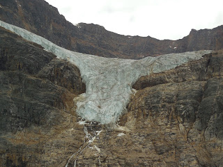
From lake level Angel Glacier does look a bit like an angel with wings outstretched. However, if you take the trail leading up the moraine above the lake, you eventually get a view of the glacier that looks just like the Texas Longhorns logo!

The Longhorn presiding over Lake Cavell and the boreal forest.

A pika, in August already accumulating supplies for the coming winter. There were also marmots scurrying around the rocks hereabout.

The Athabasca River. To me, the name evokes strong images of the north. Athabasca. Doesn't sound tropical. Pronounce the word and you almost shiver...aaaa thaaabasca. Here the river has divided, flowing around an island, and the eastern channel has a different color than the western.

Athabasca Falls, roaring through a narrow canyon. From a broad river in the above pic, the flow constricts through the limestone a little upstream. BTW the Athabasca originates from its namesake glacier upstream, portrayed in an earlier blog post.

Blow up this pic for a good image of maximum turbulence.
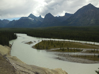
The Athabasca cuts through the Canadian Rockies. Notice the small trees on the islands...the islands are temporary, subject to floods, thus so are the trees. Another thing I realized is that while late summer is a period of drought and low river flow across much of western North America, that's not the way it is up here, because the river takes its water from the glacier, which is large and melting profusely. The lowest flows here are in late fall and winter when there is little or no glacial melt and almost no rain...all the precipitation falls as snow.

Another fine shot of the mighty Athabasca and the Canadian Rockies. Breathe deeply, and enjoy the Northland. Summer is short here...I drove some of the route with the top down on my Solara, but in the month since then it's snowed two or three times at the highest elevations of the Icefields Parkway between Jasper and Banff.
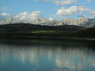
A tranquil scene at Patricia Lake, where I stayed for three days in Jasper. At dawn and dusk you can hear the loons cry...a fine voice in the wilderness.
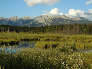
Wetland near Patricia Lake. Prime habitat for moose and grizzlies...though I didn't see either.

Pyramid Lake at dusk, with Mt Edith Cavell in the background. Just a couple km from Patricia Lake.
 Venturing from Banff to Lake Louise on the Trans Canada Highway, there are several overpasses like this one. Yes, those trees are growing on the overpass...it's a route for the critters to safely cross the freeway. On either side of the road for several kilometers fences block the wildlife from venturing onto the highway and route them toward the critter overpasses. I didn't see any moose or grizz on them, but they use 'em.
 Chateau Lake Louise, accomodating travelers in luxury for over a century. Even with the Canadian dollar cheap for us Yanquis, the rates are a bit high... like 600 Canadian per night and up.
 There are large glaciers at the far end of the lake, on the Plain of Many Glaciers. If you can hike that far, it's still civilized...there's a teahouse where you can enjoy a cuppa. I didn't make it that far. There's also another lake about 1500 feet up above Louise...also with a teahouse.
 Now I'm in a lesser known national park, Yoho, adjacent to Banff across the provincial border in British Columbia. This waterfall is about 800 feet high. It's fed by glaciers out of sight on a plateau above the falls. In Yosemite, the waterfalls peak in spring and are almost dry by August. (With the drought this year, Yosemite Falls IS dry). Takkakaw peaks in August and is at a minimum in winter, when there's no melting snow or ice to feed it.
 Another shot of Takkakaw, with its water moving downhill below the cascade. BTW Yoho is an Indian word meaning, roughly, Whoa! Cool! In otherwords, an expression of awe.


